"......... Om Shantih Shantih Shantih".
"Sail away from safe harbours. Catch the trail winds in your sails. Explore, Dream, Discover."----- Mark Twain __________________________________________________________________________________________________________

Vroom-33:
Origin: Ulm, Baden-Wurttemberg, Germany. [Coordinates: 48°24′N 9°59′E]
Destination: Hasselt, Hasselt, Belgium. [Coordinates: 50°55'N 5°20'E]
Terrain: City roads, Tunnels, Forests, Highways, Flat Lands,
Pitstops: Ulm - Stuttgart - Karlsruhe - Koblenz - Bonn - Aachen - Maastricht -
Hasselt - Juelich - Mainz - Schnelldorf - Aalen [Net Distance ~1200 km (both ways)]
Vehicle: Kawasaki Eliminator 500
Timeline: July 2024

Vroom-32:
Origin: Bangalore, Karnataka, Bharat. [Coordinates: 12°59′N 77°35′E]
Destination: Kodambakkam, Tamil Nadu, Bharat. [Coordinates: 13°03'N 80°13'E]
Terrain: City roads, Flat lands, Forests, Highways, Mountains, Coastal Roads,
Pitstops: Bangalore - Hoskote - Kolar - Palamaner - Chittoor - Vellore - Kanchipuram -
Chennai - Kodambakkam - Krishnagiri - Hosur [Net Distance ~750 km (both ways)]
Vehicle: Bajaj Dominar 400
Timeline: February 2024
Vroom-31:
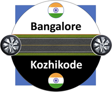
Origin: Bangalore, Karnataka, Bharat. [Coordinates: 12°59′N 77°35′E]
Destination: Kozhikode, Kerala, Bharat. [Coordinates: 11°15'N 75°46'E]
Terrain: Flat lands, Ghat roads, Forests, Mountains, Hairpin Bends,
Pitstops: Bangalore - Nelamangala - Nagamangala - Mysore - Gundlupete - Bandipur Forest -
Kalpetta - Ulliyeri - Kozhikode - Wayanad - Bidadi [Net Distance ~800 km (both ways)]
Vehicle: Bajaj Dominar 400
Timeline: February 2024
Vroom-30:
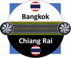
Origin: Bangkok, Thailand. [Coordinates: 13°45′N 100°29′E]
Destination: Chiang Rai, Thailand. [Coordinates: 19°54'N 99°49'E]
Terrain: Flat lands, Jungles, Village road, Ghat roads, Mountains, Hairpin Bends,
Pitstops: Bangkok - Pathum Thani - Nakhon Sawan - Tak - Lampang - Chiang Mai - Wiang Pa
Pao - Chiang Rai - Phrae - Phichit - Ang Thong [Net Distance ~1700 km (both ways)]
Vehicle: Yamaha MT-15
Timeline: December 2023
Vroom-29:
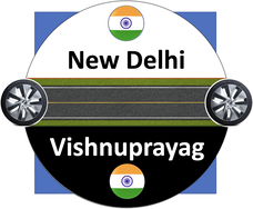
Origin: New Delhi, NCR, Bharat. [Coordinates: 28°36′N 77°12′E]
Destination: Vishnuprayag, Uttarakhand, Bharat. [Coordinates: 30°33'N 79°34'E]
Terrain: Flat lands, Jungles, Village road, Ghat roads, Mountains, Hairpin Bends, Tunnels,
Pitstops: New Delhi - Roorkee - Haridwar - Rishikesh - Devprayag - Rudraparayag - Karnaprayag
- Nandaprayag - Joshimath - Vishnuprayag [Net Distance ~1050 km (both ways)]
Vehicle: Royal Enfield Himalayan
Timeline: December 2023
Vroom-28:
Origin: Ulm, Baden-Wurttemberg, Germany. [Coordinates: 48°24′N 9°59′E]
Destination: Berlin, Berlin-Brandenburg, Germany. [Coordinates: 52°31'N 13°24'E]
Terrain: Flat lands, Jungles, Village road, Tunnels,
Pitstops: Ulm - Gunzburg - Augsburg - Donauworth - Nurnberg - Bayreuth - Eisenberg -
- Berlin - Halle - Erfurt - Wurzberg - Elchingen [Net Distance ~1320 km (both ways)]
Vehicle: Kawasaki Z650
Timeline: August 2023
Vroom-27:
Origin: Jammu, Jammu & Kashmir, Bharat. [Coordinates: 32°73′N 74°87′E]
Destination: Srinagar, Jammu & Kashmir, Bharat. [Coordinates: 34°5'N 74°47'E]
Terrain: Flat lands, Jungles, Ghat Roads, Tunnels, Valley roads,
Pitstops: Jammu - Domel - Udhampur - Chenani - Chanderkote - Ramban - Teli - Banihal
- Qazigund - Awantipora - Pampora - Srinagar [Net Distance ~500 km (both ways)]
Vehicle: Royal Enfield Himalayan
Timeline: May 2023
Vroom-26:
Origin: Bangalore, Karnataka, Bharat. [Coordinates: 12°59′N 77°35′E]
Destination: Kalasa, Karnataka, Bharat. [Coordinates: 13°14'N 75°21'E]
Terrain: Flat lands, Rural patches, Jungles, Ghat Roads, Village roads,
Pitstops: Bangalore - Kunigal - Channarayapatna - Hassan - Sakleshpura - Mudigere - Kelagur
- Hirebellu - Kalasa - Silent Valley Resort - Belur [Net Distance ~650 km (both ways)]
Vehicle: Bajaj Dominar 400
Timeline: April 2023
Vroom-25:
Origin: Bangalore, Karnataka, Bharat. [Coordinates: 12°59′N 77°35′E]
Destination: Dhanushkodi, Tamilnadu, Bharat. [Coordinates: 9°15'N 79°45'E]
Terrain: Flat lands, Rural patches, Jungles, Village roads, Beaches,
Pitstops: Bangalore - Tiruvannamalai - Chidambaram - Thanjavur - Tiruchirappalli - Karaikudi - Rameshwaram - Dhanushkodi - Madurai - Salem [Net Distance ~1500 km (both ways)]
Vehicle: Bajaj Dominar 400
Timeline: April 2023
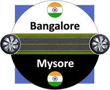
Vroom-24:
Origin: Bangalore, Karnataka, Bharat. [Coordinates: 12°59′N 77°35′E]
Destination: Mysore, Karnataka, Bharat. [Coordinates: 12°18'N 76°39'E]
Terrain: Flat lands, Rural patches, Ghat roads, Jungles, Village roads, hills,
Pitstops: Bangalore - Arisinakunte - Bellur Cross - Samaka hally- Mysore - Chamundi Hills -
Bannur - Mandya- Bidadi [Net Distance ~360 km (both ways)]
Vehicle: Bajaj Dominar 400
Timeline: February 2023
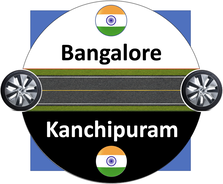
Vroom-23:
Origin: Bangalore, Karnataka, Bharat. [Coordinates: 12°59′N 77°35′E]
Destination: Kanchipuram, Tamilnadu, Bharat. [Coordinates: 12°49'N 79°41'E]
Terrain: Flat lands, Rural patches, Ghat roads, Jungles,
Pitstops: Bangalore - Hoskote - Kolar Goad Fields - Gudiyatham- Vellore - Arkot - Kanchipuram
- Ambur- Krishnagiri- Hosur [Net Distance ~570 km (both ways)]
Vehicle: Bajaj Dominar 400
Timeline: February 2023
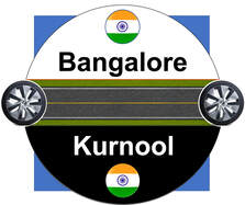
Vroom-22:
Origin: Bangalore, Karnataka, Bharat. [Coordinates: 12°59′N 77°35′E]
Destination: Kurnool, Andhra Pradesh, Bharat. [Coordinates: 15°83'N 78°05'E]
Terrain: Flat lands, Jungles, Rural patches,
Pitstops: Bangalore - Devanahally - Chikkaballapur - Bagepalli- Penukonda
- Anantapur- Gooty- Dhone- Kurnool [Net Distance ~720 km (both ways)]
Vehicle: Bajaj Dominar 400
Timeline: February 2023
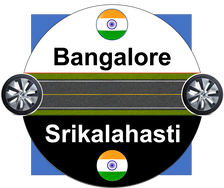
Vroom-21:
Origin: Bangalore, Karnataka, Bharat. [Coordinates: 12°59′N 77°35′E]
Destination: Srikalahasti, Andhra Pradesh, Bharat. [Coordinates: 13°45'N 79°42'E]
Terrain: Flat lands, Ghat Roads, Jungles, Rural patches
Pitstops: Bangalore - Hoskote - Narsapura - Kolar - Mulbagal - Palmaner
- Chittoor - Tirupati- Yerpadu- Srikalahasti [Net Distance ~570 km (both ways)]
Vehicle: Bajaj Dominar 400
Timeline: January 2023
Vroom-20:
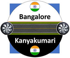
Origin: Bangalore, Karnataka, Bharat. [Coordinates: 12°59′N 77°35′E]
Destination: Kanyakumari, Tamilnadu, Bharat. [Coordinates: 8°5'N 77°32'E]
Terrain: Flat lands, Rural patches, Ghat Roads, Jungles, Beach roads, Coastal roads
Pitstops: Bangalore - Mangalore - Thrissur - Trivandrum - Kanyakumari - Rameswaram
- Chidambaram - Pondicherry- Kanchipuram [Net Distance ~2300 km (both ways)]
Vehicle: Bajaj Dominar 400
Timeline: December 2020
Vroom-19:
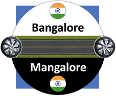
Origin: Bangalore, Karnataka, Bharat. [Coordinates: 12°59′N 77°35′E]
Destination: Mangalore, Karnataka, Bharat. [Coordinates: 12.47°N 74.50°E]
Terrain: Flat lands, Jungles, Rural patches, Ghat roads, Beach roads
Pitstops: Bangalore - Sira - Challekere - Chitradurga - Shivamogga - Udupi
- Mangalore - Hasan [Net Distance ~900 km (both ways)]
Vehicle: Bajaj Dominar 400
Timeline: November 2020
Vroom-18:
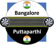
Origin: Bangalore, Karnataka, Bharat. [Coordinates: 12°59′N 77°35′E]
Destination: Puttaparthi, Andhra Pradesh, Bharat. [Coordinates: 14.166°N 77.811°E]
Terrain: Flat lands, Rural patches
Pitstops: Bangalore - Tharabanahalli - Nandi Hills - Bagepalli - Lepakshi - Gorantla - Puttaparthi
[Net Distance ~400 km (both ways)]
Vehicle: Bajaj Dominar 400
Timeline: February 2020
Vroom-17:
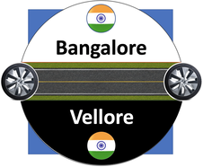
Origin: Bangalore, Karnataka, Bharat. [Coordinates: 12°59′N 77°35′E]
Destination: Vellore, Tamilnadu, Bharat. [Coordinates: 12.920219°N 79.133306°E]
Terrain: Flat lands, Ghats
Pitstops: Bangalore - Hoskote - Kolar - Mulbagal - Palamaner - Chittoor - Vellore
[Net Distance ~450 km (both ways)]
Vehicle: Bajaj Dominar 400
Timeline: January 2020
Vroom-16:
Origin: Bangalore, Karnataka, Bharat. [Coordinates: 12°59′N 77°35′E]
Destination: Coimbatore, Tamilnadu, Bharat. [Coordinates: 11°1′6″N 76°58′21″E]
Terrain: Flat lands, Mountains, Hairpin bends, Ghats
Pitstops: Bangalore - Ramanagara - Maddur - Somanathapura - Gundlupet - Ooty - Coimbatore
[Net Distance 750 km (both ways)]
Vehicle: Bajaj Dominar 400
Timeline: January 2019
Vroom-15:
Origin: Bangalore, Karnataka, Bharat. [Coordinates: 12°59′N 77°35′E]
Destination: Chennai, Tamilnadu, Bharat. [Coordinates: 13°5′N 80°16′E]
Terrain: Flat lands
Pitstops: Bangalore - Hosur - Krishnagiri - Ambur - Vellore - Kanchipuram - Chennai
[Net Distance ~700 km (both ways)]
Vehicle: Bajaj Dominar 400
Timeline: December 2018
Vroom-14:
Origin: Bangalore, Karnataka, Bharat. [Coordinates: 12°59′N 77°35′E]
Destination: Perundurai, Tamilnadu, Bharat. [Coordinates: 11.27°N 77.58°E]
Terrain: Flat lands, Mountains
Pitstops: Bangalore - Hosur - Krishnagiri - Dharmapuri - Salem - Bhavani - Perundurai
[Net Distance ~620 km (both ways)]
Vehicle: Bajaj Dominar 400
Timeline: August 2018
Vroom-13:
Origin: Bangalore, Karnataka, Bharat. [Coordinates: 12°59′N 77°35′E]
Destination: Coorg, Karnataka, Bharat. [Coordinates: 12.4209°N 75.7397°E]
Terrain: Flat lands, Mountains, Hairpin bends, Ghats
Pitstops: Bangalore - Nelamangala - Kunigal - Channarayapattana - Shravanbelagola - Hassan -
- Ramanathapura - Kushalnagar - Coorg [Net Distance ~540 km (both ways)]
Vehicle: Bajaj Dominar 400
Timeline: March 2018
Vroom-12:
Origin: Halifax, Nova Scotia, Canada. [Coordinates: 44°38′51″N 63°35′26″W]
Destination: Peggy's Cove, Nova Scotia, Canada. [Coordinates: 44°29′34″N 63°55′03″W]
Terrain: Flat lands, Beaches
Pitstops: Halifax - Goodwood - Brookside - Shad Bay - West Dover - Peggy's Cove
[Net Distance ~80 km (both ways)]
Vehicle: Honda City
Timeline: December 2008
Vroom-11:
Origin: Piscataway, New Jersey, USA. [Coordinates: 40.54564°N 74.460817°W]
Destination: Halifax, Nova Scotia, Canada. [Coordinates: 44°38′51″N 63°35′26″W]
Terrain: Flat lands, Mountains, Tunnels, Beaches
Pitstops: Piscataway - New York - New Haven - Hartford - Worcester - Portland - Milltown -
Moncton - Milford - Dartmouth - Halifax [Net Distance ~3000 km (both ways)]
Vehicle: Honda City
Timeline: November-December 2008
Vroom-10:
Origin: Piscataway, New Jersey, USA. [Coordinates: 40.54564°N 74.460817°W]
Destination: Upton, New York, USA. [Coordinates: 40°52′10″N 72°53′12″W]
Terrain: Flat lands, Mountains, Forests
Pitstops: Piscataway - Elizabeth - New York - Queens - Suffolk - Long Island - Upton
[Net Distance ~350 km (both ways)]
Vehicle: Toyata Land Cruiser
Timeline: November 2008
Vroom-09:
Origin: Honolulu, Hawaii, USA. [Coordinates: 21°18′25″N 157°51′30″W]
Destination: Pearl Harbour, Hawaii, USA. [Coordinates: 21.3679°N 157.9771°W]
Terrain: Flat lands, Mountains, Beaches
Pitstops: Honolulu - Kalihi Palama - Forest City - Pearl Harbour
[Net Distance ~35 km (both ways)]
Vehicle: Vespa Scooter
Timeline: October 2008
Vroom-08:
Origin: Cancun, Quintana Roo, Mexico. [Coordinates: 21°09′38″N 86°50′51″W]
Destination: Chichen Itza, Yucatan, Mexico. [Coordinates: 20°40′59″N 88°34′7″W]
Terrain: Flat lands, Mountains
Pitstops: Cancun - Leona Vicario - Ignacio Zaragoza - Sisbichen - Valladolid - Piste - Chichen Itza
[Net Distance ~420 km (both ways)]
Vehicle: Jeep
Timeline: September 2008
Vroom-07:
Origin: Santa Barbara, California, USA. [Coordinates: 34°25′N 119°42′W]
Destination: San Diego, California, USA. [Coordinates: 32°42′54″N 117°09′45″W]
Terrain: Flat lands, Beaches,
Pitstops: Santa Barbara - Ojai - Ventura - Thousand Oaks - Los Angeles - Long Beach - Irvine -
San Clemente - Carlsbad - San Diego [Net Distance ~850 km (both ways)]
Vehicle: Toyota Land Cruiser
Timeline: September 2008
Vroom-06:
Origin: Piscataway, New Jersey, USA. [Coordinates: 40.54564°N 74.460817°W]
Destination: Andover, New Hampshire, USA. [Coordinates: 43°26′11″N 71°49′24″W]
Terrain: Flat lands, Lakes, Mountains
Pitstops: Piscataway - Newark - Stamford - New Haven - Auburn - Worcester - Charles Town -
Nashua - Manchester - Concord - Andover [Net Distance ~650 km (both ways)]
Vehicle: Honda City
Timeline: August 2008
Vroom-05:
Origin: Tempe, Arizona, USA. [Coordinates: 33°24′46″N 111°56′35″W]
Destination: Grand Canyon, Arizona, USA. [Coordinates: 36°18′N 112°36′W]
Terrain: Flat lands, Deserts, Dunes, Mountains
Pitstops: Tempe - Phoenix - Morris Town - Wikieup - Kingman - Grand Canyon
[Net Distance ~670 km (both ways)]
Vehicle: Mazda CX
Timeline: May 2008
Vroom-04:
Origin: Piscataway, New Jersey, USA. [Coordinates: 40.54564°N 74.460817°W]
Destination: Pittsburgh, Pennsylvania, USA. [Coordinates: 40°26′23″N 79°58′35″W]
Terrain: Flat lands, Tunnels
Pitstops: Piscataway - Bedminster - Clinton - Bethlehem - Allentown - Harrisburg - Newberg -
Somerset - New Stanton- Pittsburg [Net Distance ~740 km (both ways)]
Vehicle: Nissan Infiniti
Timeline: November 2007

Vroom-03:
Origin: Piscataway, New Jersey, USA. [Coordinates: 40.54564°N 74.460817°W]
Destination: Washington DC, USA. [Coordinates: 38°54′17″N 77°00′59″W]
Terrain: Flat lands
Pitstops: Piscataway - Trenton - Philadelphia - Wilmington - Baltimore - Washington DC
[Net Distance ~710 km (both ways)]
Vehicle: Honda City
Timeline: October 2007
Vroom-02:
Origin: Piscataway, New Jersey, USA. [Coordinates: 40.54564°N 74.460817°W]
Destination: Atlantic City, New Jersey, USA. [Coordinates: 39.377297°N 74.451082°W]
Terrain: Flat lands, Beaches
Pitstops: Piscataway - Edison - Middletown - Brick Township - Barnegat Township - Atlanic City
[Net Distance ~385 km (both ways)]
Vehicle: Honda City
Timeline: September 2007
Vroom-01:
Origin: Piscataway, New Jersey, USA. [Coordinates: 40.54564°N 74.460817°W]
Destination: New London, New Hampshire, USA. [Coordinates: 43°24′50″N 71°59′07″W]
Terrain: Flat lands, Lakes, Mountains
Pitstops: Piscataway - Newark - Stamford - New Haven - Hartford - Springfield - Charles
Town - New Port - Sunapee - New London [Net Distance ~610 km (both ways)]
Vehicle: Honda City
Timeline: August 2007

Doppler-26:
Origin: Vilnius, Lithuania. Destination: Riga, Latvia. Carrier: Lithuanian Railways Timeline: Jul 2024 
Doppler-24:
Origin: Varanasi, UP, Bharat. Destination: New Delhi, NCR, Bharat. Carrier: Indian Railways Timeline: Dec 2023 |

Doppler-25:
Origin: Monte Carlo, Monaco. Destination: Munich, Germany. Carrier: ItaliaRail Timeline: Jul 2024 
Doppler-23:
Origin: Rome, Italy. Destination: Ulm, Germany. Carrier: ItaliaRail Timeline: Dec 2022 |

Doppler-22:
Origin: Athens, Greece. Destination: Thessaloniki, Greece. Carrier: Hellenic Trainways Timeline: Dec 2022 |
Doppler-21:
Origin: Caen, France. Destination: Stuttgart, Germany. Carrier: TGV Railways France Timeline: Dec 2022 |
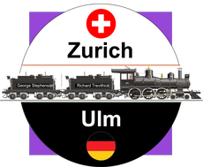
Doppler-20:
Origin: Zurich, Switzerland. Destination: Ulm, Germany. Carrier: Swiss Railways Timeline: Oct 2022 |
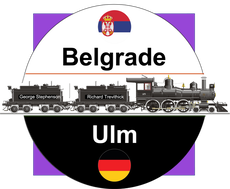
Doppler-19:
Origin: Belgrade, Serbia. Destination: Ulm, Germany. Carrier: Multiple Carriers Timeline: Oct 2022 |
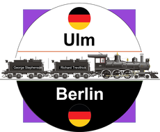
Doppler-18:
Origin: Ulm, Germany. Destination: Berlin, Germany. Carrier: Deutsche Bahn Timeline: Jun 2022 |
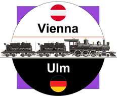
Doppler-17:
Origin: Vienna, Austria. Destination: Ulm, Germany. Carrier: Austrian Railways Timeline: May 2022 |
Doppler-16:
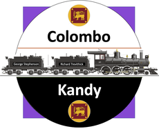
Origin: Colombo, Sri Lanka. Destination: Kandy, Sri Lanka. Carrier: Lankan Railways Timeline: Dec 2014 |
Doppler-15:
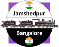
Origin: Jamshedpur, JH, Bharat. Destination: Bangalore, KA, Bharat. Carrier: Indian Railways Timeline: Feb 2014 |
Doppler-14:
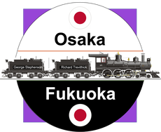
Origin: Osaka, Japan. Destination: Fukuoka, Japan. Carrier: Japan Railways Timeline: Jul 2013 |

Doppler-13:
Origin: Ulsan, South Korea. Destination: Seoul, South Korea. Carrier: Korea Railways Timeline: Jul 2013 |
Doppler-12:
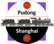
Origin: Pudong, China. Destination: Shanghai, China. Carrier: Pudong MagLev Timeline: May 2013 |
Doppler-11:
Origin: Tokyo, Japan. Destination: Nagoya, Japan. Carrier: JR Railways Timeline: Oct 2011 |
Doppler-10:
Origin: Tokyo, Japan. Destination: Niigata, Japan. Carrier: JR Railways Timeline: Jun 2011 |

Doppler-09:
Origin: Tokyo, Japan. Destination: Sendai, Japan. Carrier: JR Railways Timeline: Jun 2011 |
Doppler-08:
Origin: Amiens, Picardie, France. Destination: Bordeaux, France. Carrier: TGV Railways France Timeline: Jul 2010 |
Doppler-07:
Origin: Amiens, Picardie, France. Destination: Brussels, Belgium. Carrier: TGV Railways France Timeline: Apr 2010 |
Doppler-06:
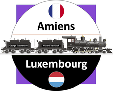
Origin: Amiens, Picardie, France. Destination: Luxembourg, Luxembourg. Carrier: TGV Railways France Timeline: Apr 2009 |
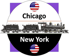
Doppler-05:
Origin: Chicago, Illinois, IL, USA. Destination: New York, NY, USA. Carrier: Amtrak Railways Timeline: May 2008 |

Doppler-04:
Origin: Washington DC, Capitol, USA. Destination: New York, USA. Carrier: Amtrak Railways Timeline: May 2006 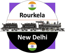
Doppler-02:
Origin: Rourkela, Odisha, Bharat. Destination: Bangalore, Karnataka, Bharat. Carrier: Indian Railways Timeline: Feb 2002 |
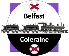
Doppler-03:
Origin: Belfast, North Ireland. Destination: Coleraine, North Ireland. Carrier: British Railways Timeline: Feb 2004 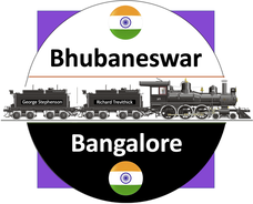
Doppler-01:
Origin: Bhubaneswar, Odisha, Bharat. Destination: Bangalore, Karnataka, Bharat. Carrier: Indian Railways Timeline: May 2001 |
|
|
|